October 2001
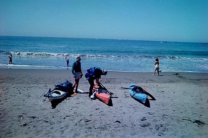
Muir Beach
This put-in is Rated R for nudity
Protected from the prevailing NW swell this put-in usually offers easy landing and launches. It is exposed to South/West wind and swell.
If you want to get that wetsuit off as soon as possible you can here;
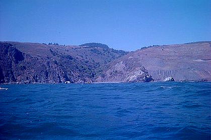
As you paddle South to Pirates or Tennessee Valley Coves the coast becomes more exposed to the NW wind and swell making landing and launches more challenging. Also headwind and resultant current can make it difficult to get back to Muir Beach. A favorite BASK tactic is to go 1-way from here to Horseshoe Cove.
Paddling North the area is known for intense wind and wave chop. The cliffs on the coast North of Muir Beach reflects incoming waves back out to sea. High tide and heavy Afternoon winds can make this a challenging paddle. 2nd only to nearby Potato Patch for extreme ocean conditions this area can have high chop; 4-6' of "Devil's water" and the following seas on the way back can feature breaking windwaves!
Every year great white sharks are sighted in this area. Don't sit still, travel in groups and size does matter 15' or longer!
A fun paddle is to paddle North 2 and a half miles to Lone Tree Creek
Just past a massive landslide this beach has a small arch and a small stream. Although more exposed than Muir Beach usually this beach is easy to land on and to launch from. After lunch you can paddle North to Red Rock Beach
![]()
Disclaimer
These are put-ins that I have used, and maybe totally different when you are there, in other words, paddle at your own risk.
Always check weather and ocean conditions before you paddle!
Site Map
| Trips | Short Stories 1 | Short Stories 2 | Seacave Story |
| Kayak Put-ins | Kayak Surfing Tips | Weather Tips | Ocean Wave Conditions |
| Weather & Kayak Links | Home | E-me if you're looking for a paddle partner | Red Rock |
copyright Storm Steiger 2000
sea kayakers have visited this
page since it was created October 2001